The Pyrenees Trail GR10 is a fantastic long-distance trail in the French Pyrenees. Stretching 935km from Hendaye at the Atlantic to Banyuls-sur-Mer at the Mediterranean coast, it takes you through marvellous landscapes. For hikers not speaking German, my English hiking guidebook is now available on Amazon, based on the popular German original.
The wait is finally over

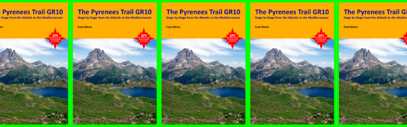
After an incredible amount of work and countless sleepless nights, I have finally finished and self-published my English guidebook “The Pyrenees Trail GR10 – Stage by Stage from the Atlantic to the Mediterranean”. You can find it on Amazon by searching for the ISBN number 9783982411606 where you can also take a peek into it with Amazon’s “Look inside” feature.
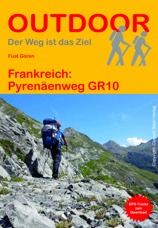
The book is roughly based on my German hiking guidebook “Frankreich: Pyrenäenweg GR 10” (ISBN 9783866865754). That one had been published by my German publisher Conrad Stein Verlag.
For my English guidebook I am author, photographer, graphic designer, layouter, editor and publisher all rolled into one. While working on it, I made some changes and included updates I researched on subsequent hikes in the Pyrenees.
What and where is the Pyrenees Trail GR10?
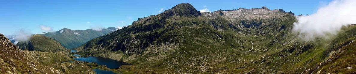
The book describes the fantastic Pyrenees Trail GR10 which crosses the French part of the the mountain range between France and Spain from the Atlantic to the Mediterranean. This marvellous trail takes you through majestic scenery, past sublime lakes and UNESCO World Heritage Sites and some of the highest Pyrenees peaks, with each of the 4 main Pyrenees sections (Pyrénées-Atlantiques, Pyrénées-Centrales, Pyrénées-Ariégeoises, Pyrénées-Orientales) having its own, distinct and magical character.
You can find a much more detailed description of the Pyrenees and the GR10 trail here on my website. If you don’t speak German, you might be able to read it using online translation tools.
Who is this book for?
While on the GR10 and other hikes in the fabulous Pyrenees, I encountered many international hikers who didn’t speak German. They’d tell me they had seen many hikers from Germany, Switzerland, Austria, etc., who hiked the trail with my German hiking guidebook.
Since they didn’t speak German, they had other GR10 guidebooks with them. They were surprised and kind of envious about how detailed yet structured my German book was, but at the same time small and lightweight, fitting into pants pockets. And they’d tell me they wished it was also available in English, as their books were heavier and bulkier and/or less detailed than mine. I myself had already been playing with the idea of an English version at the time, and their feedback affirmed my intention.
So, to all hikers out there who are thinking of hiking the GR10, but who don’t speak any or not enough German. Whether you are from Europe, the Americas, Africa, Asia or Australia-Oceania. This book is for all of you! The links below take you directly to my book on the Amazon marketplace applicable for you:
- for the USA and all countries not listed below
- for Australia
- for Brazil
- for Canada
- for France
- for Germany
- for India
- for Italy
- for Japan
- for Mexico
- for the Netherlands
- for Spain
- for the UK
Layout and structure
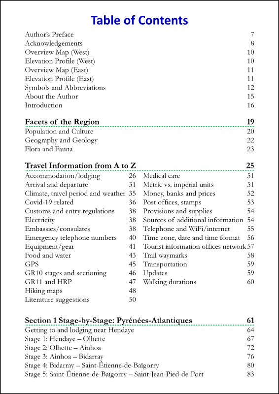
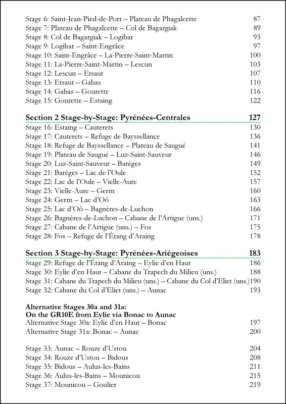
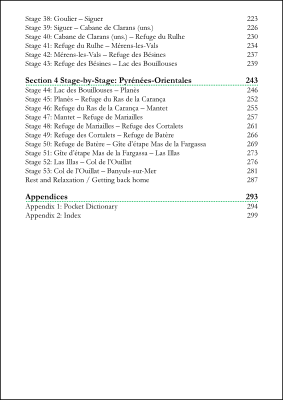
With its 301 pages, the book offers lots of details, yet is very clear-structured. Whether you plan to thruhike or just walk parts of the GR10, with my book you’ll be able to confidently set out with all needed information directly in each stage.
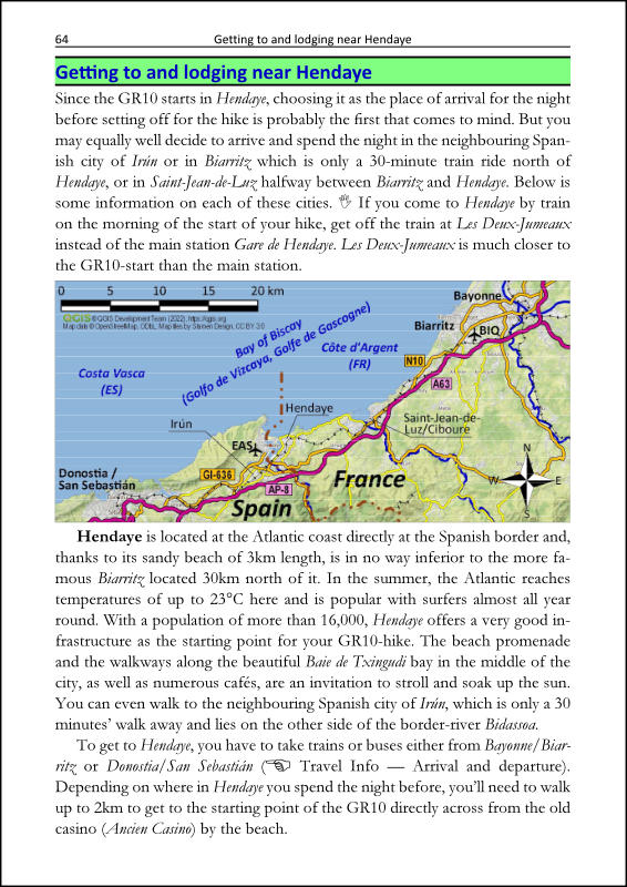
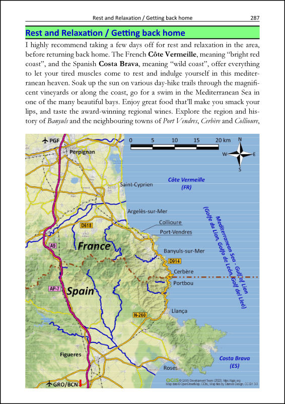
The trail is described stage by stage in 53 main stages and 2 optional alternative stages. Each stage contains detailed descriptions of the trail, including alerts about poorly-marked parts or potentially dangerous or hazardous segments. Two additional chapters provide lodging information around the greater Hendaye (at the Atlantic) and Banyuls-sur-Mer (at the Mediterranean) regions.
The eBook is formatted as a “print-replica” in order to preserve the specific layout of all elements (maps, elevation profiles, tabular listings of POIs, distances and walking times, etc.).
Main features
Below are some of the main features of the book (please note: resolution of all pictures shown below is reduced for better webpage-loading; the actual contents of the eBook are in high-resolution):
- the eBook can be used on any smartphone with the free Kindle app, no separate device or eBook-reader needed;
- once purchased and downloaded to your Kindle app, you can read it offline on the trail and anywhere, no internet connection needed;
- each entry of the table of contents can be addressed directly, since the detailed TOC is included as a menu item in the Kindle app;
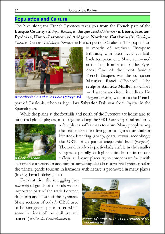
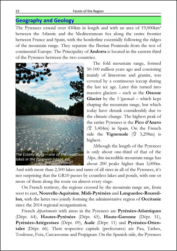
- introductory sections provide useful information about population and culture, geography and geology, and flora and fauna;
- a dedicated section provides detailed travel information from A to Z, including useful topics such as public transportation, tourist information network, selected embassies and consulates, travel period, emergency telephone numbers, hiking maps, medical care, provisions and supplies, and many more;
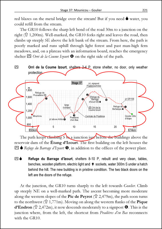
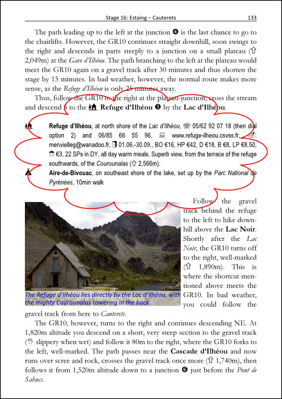
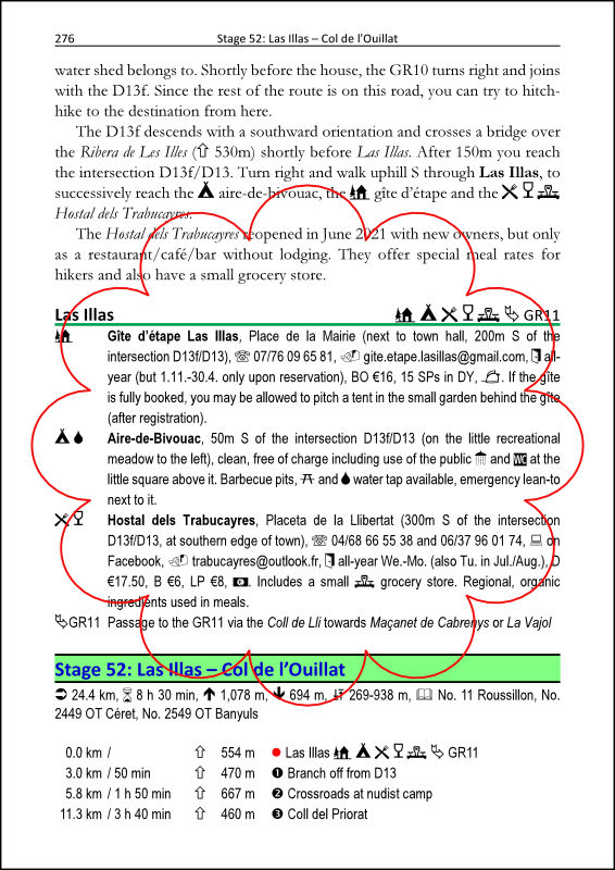
- all numbered waypoints mentioned in each stage’s text are also conveniently listed in the summary table at the beginning of each stage, including distances and standardized walking times, and also shown on the stage maps and elevation profiles; in addition, each stage starts with a brief general introduction text;
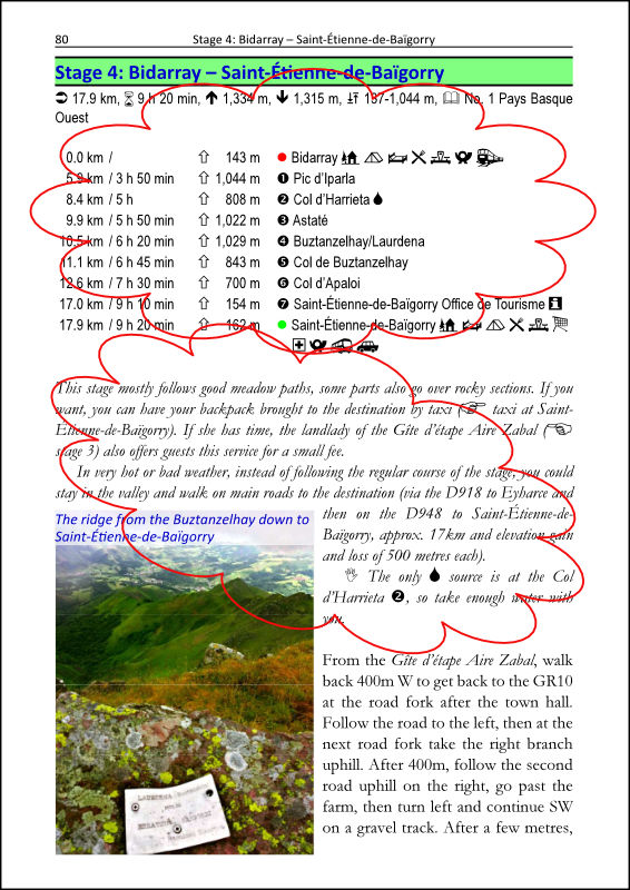
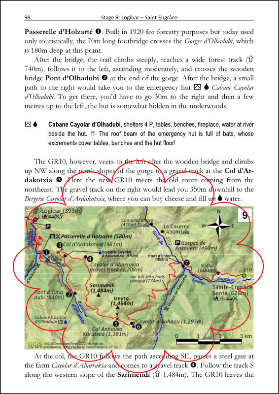
- 58 coloured stage maps scale 1:150,000 (at least one in each stage);
- 55 elevation profiles (one in each stage incl. the two variant/alternative stages);
- 125 colour photographs and illustrations;
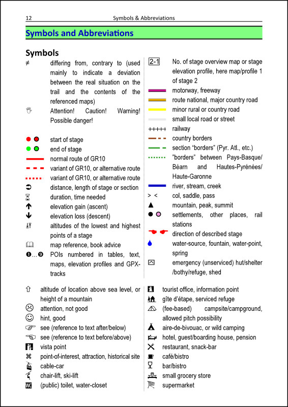
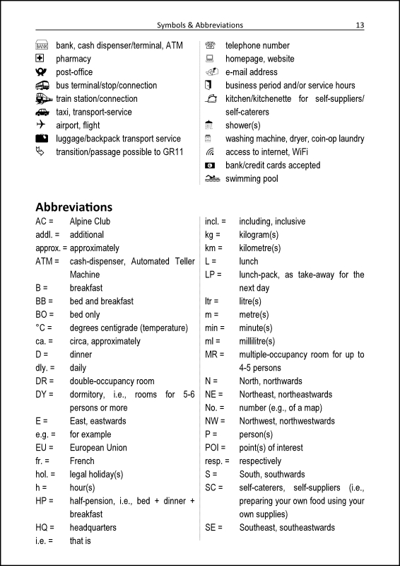
- catchy symbols make it easy to find important information in the stage texts and maps at a glance;

- the GPX-files for all stages as described in the book can be downloaded free of additional charge by following the instructions given in the book; they include not only the tracks (including variants) and the numbered waypoints of each stage, but also many additional POIs along the trail;
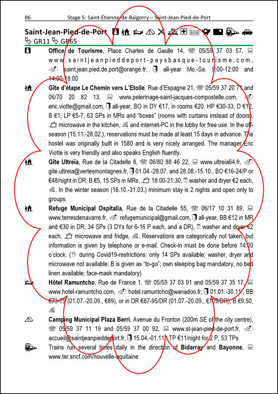
- detailed lodging info directly in each stage, no need to flip pages back and forth between a stage and the end of the book as in some other guidebooks; lodging info provided includes name, location, contact info, number of sleeping places, business periods, services provided and prices;
- where they exist, alternatives and variants (e.g., for bad weather), or other important info, are described in highlighted sections directly in each stage;
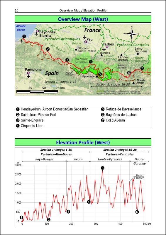
- 2 coloured general overview maps and overview elevation profiles, one each for the west and east half of the trail;
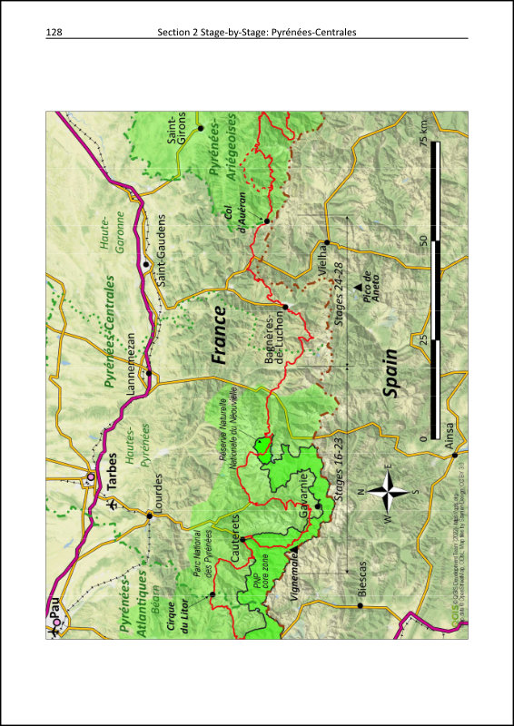
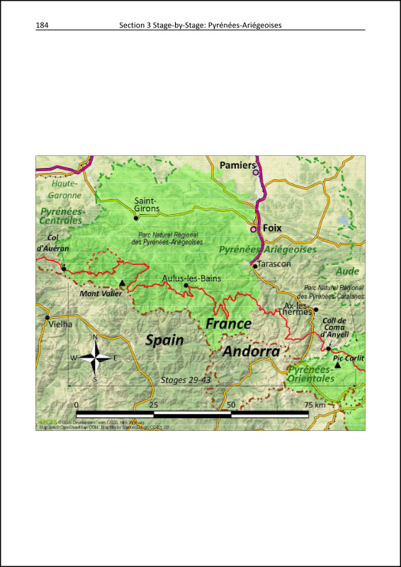
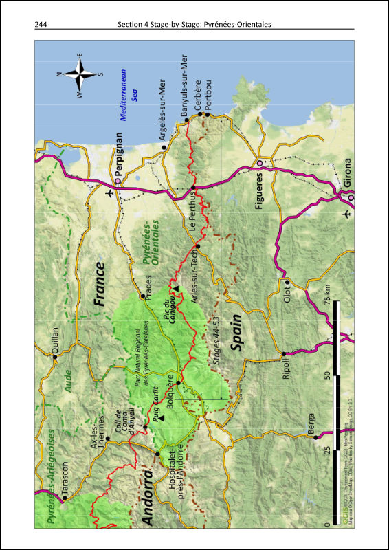
- separate introductory sections with coloured segment overview maps, for each of the 4 distinct Pyrenees-segments (Pyrénées-Atlantiques, Pyrénées-Centrales, Pyrénées-Ariégeoises, Pyrénées-Orientales);

- 2 coloured overview maps for the greater Hendaye (Atlantic coast) and Banyuls-sur-Mer (Mediterranean coast) regions;
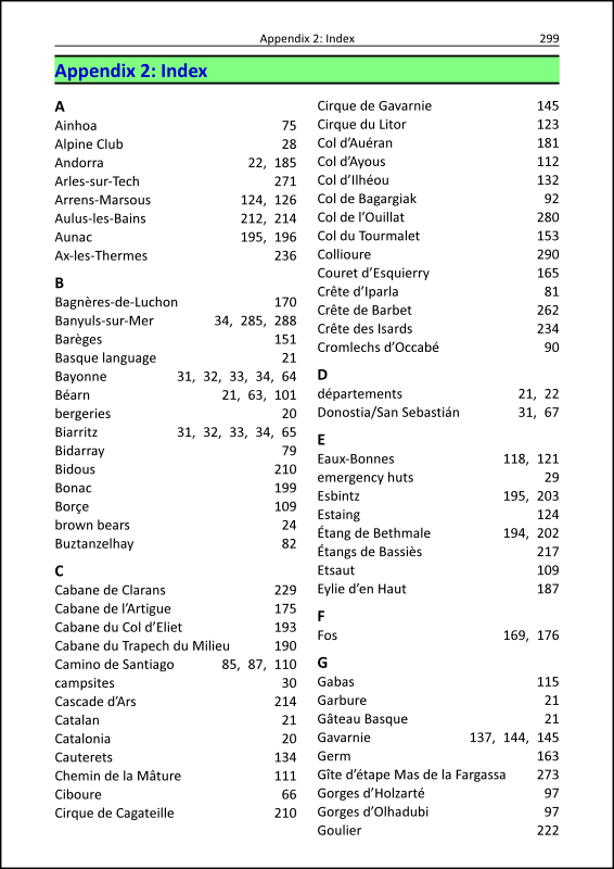
- Appendix with keyword-index for easy finding of places and topics of interest;
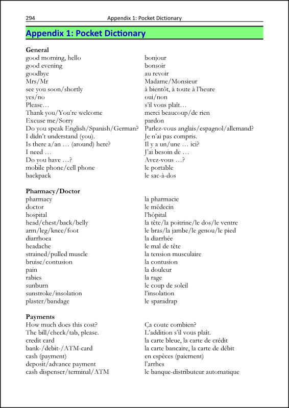
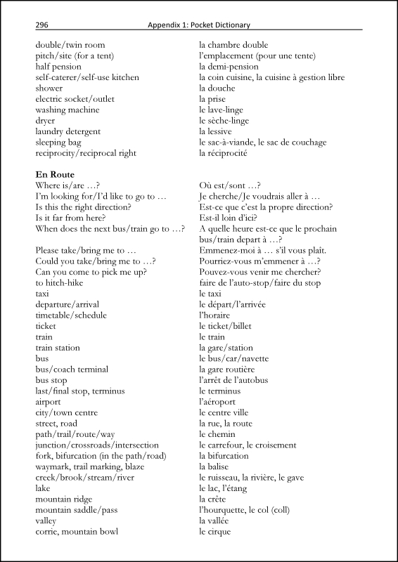
- Appendix with a “pocket dictionary” English-French with useful words and phrases grouped for various purposes (general, health, payments, food, lodging, on the trail, weather, numbers, time, calendar);
Don’t leave home without it
If you are planning to hike the Pyrenees trail GR10, then this guidebook is an invaluable resource. Not only will it be of great help when you’re out on the trail, but also when you’re preparing the details of your trip before you set off.
Nowadays almost nobody leaves home without their smartphone. Therefore, it makes perfect sense to also have your trail guidebook with you as an eBook, if you don’t want to carry the additional weight of a printed book.
So don’t hesitate, go get it on Amazon and also let your hiking-enthusiast friends, family and relatives all around the world know about it. Spread the word by forwarding this blogpost to others who might be looking for an excellent hiking guidebook for the Pyrenees trail GR10, or who might be looking for inspiration on where to go hiking next.
Thanks, and as always happy trails,
Fuat